Below is a LiDAR image of this area:
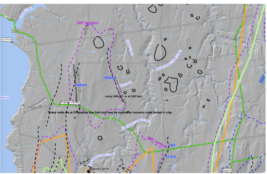
The major focus in this map area are multiple nobs, as shown by more or less circular black lined features, all of which suggest nobs at an elevation of about 200 feet (61 m). These were identified on VCGI maps, specifically and only at certain scales, at which the presence of multiple closed contours is depicted, all at an elevation of about 200 feet (61 m). All of the roads in this area, including many scattered unmarked farm roads were followed to examine multiple nobs. This showed that the nobs are in fact bonafide local topographic highs, and not some quirky topographic survey artifact. Whereas one gets a sense of more bouldery soils in the vicinities of these nobs, based on rock piles at the margins of farm fields, no exposures were found on most nobs.
However, at one location, on a prominent nob, the excavation for a house foundation showed very compact, dense, firm, stony glacial till, with no lacustrine silt-clay cover. This is taken as an indication that these nobs were formed by the ice sheet. Given that lacustrine and marine silt clay soils form an extensive, near universal veneer across the entire landscape in this area, the presence of till on a knob, with no silt-clay cover soil, is an important, remarkable finding, taken as evidence supporting the interpretation that these nobs are terrain highs on transverse morainic ridges, again as described in the literature discussed above (reference for example the Batchelor and Dowdeswell illustration).