As can be seen on the above Batchelor and Dowdeswell illustration, calving ice streams are also associated with and marked by other features as part of the geological record, specifically “Transverse retreat moraines” and “stream-lined lineations.” Whereas the latter are depicted on their illustration as being located downgradient from the transverse moraines this was done for graphical convenience. As described by the authors, such lineations tend to form beneath the ice, upgradient from the grounding line. As discussed above, the linears southwest of Vergennes and northwest of Snake Mountain are identified as possible “stream-lined lineations,” more specifically referred to in the previous 2025 report as possible Mega-Scale-Lineations. Important information regarding these features was identified in the present field study, as discussed below.
Regarding the “transverse morainic ridges,” the map below shows scattered nobs, as marked by the neon blue green patterns, as identified on LiDAR imagery:
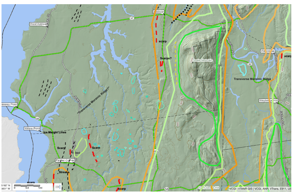
This map is on the main basin floor, southwest of the previous location, west of Snake Mountain and Route 22A. The early and late T4 margins and the Champlain Sea are marked as noted previously. Interestingly, the presence of nobs is only evident at certain levels of magnification. Some of the nobs are evident by small, local, closed contours, but in many places are evident only from spot elevations. These nobs were examined in the field, with more detailed information presented in that section below. As reported, this field examination confirmed the nobs as actual, real topographic features and found evidence supporting the interpretation that they represent Transverse Morainic Ridges.